
How to Subdivide Property in Augusta, Georgia

Whether you’re looking to create a family estate, sell a portion of your land, develop a residential neighborhood, or maximize the value of your property, subdividing land can be an excellent investment strategy. However, property subdivision in Augusta, Georgia and throughout the Central Savannah River Area (CSRA) involves much more than simply drawing a line on a map.
Local zoning regulations, minimum lot requirements, utility availability, access requirements, and municipal approvals all play a role in determining whether a subdivision is possible.
At H&M Surveying, we regularly assist property owners, developers, real estate professionals, and attorneys throughout Augusta, Evans, Grovetown, Harlem, Appling, Martinez, and the surrounding CSRA with the land subdivision process. Understanding the steps involved can help you avoid costly delays and ensure your project moves forward efficiently.
What Does It Mean to Subdivide Property?
A subdivision occurs when a larger parcel of land is divided into two or more separate lots. Once approved and recorded, each lot becomes an independent tract that can be sold, developed, financed, or transferred individually.
Property owners commonly subdivide land for:
- Selling a portion of their property
- Creating lots for family members
- Residential development projects
- Commercial development
- Estate planning purposes
- Increasing property value through lot creation
The subdivision process must comply with local ordinances and land development regulations before new lots can legally exist.
Step 1: Determine Whether Your Property Can Be Subdivided
The first step is determining whether the property meets local subdivision requirements.
Several factors affect subdivision eligibility, including:
Zoning Requirements
Every property is assigned a zoning classification that dictates:
- Minimum lot sizes
- Minimum frontage requirements
- Setback requirements
- Density limitations
- Permitted land uses
A property located in Richmond County may have different requirements than one located in Columbia County or Burke County.
Access Requirements
Each newly created lot typically must have legal access to a public road or approved private roadway.
Landlocked parcels can create significant challenges and may require easements or roadway improvements before approval.
Utility Availability
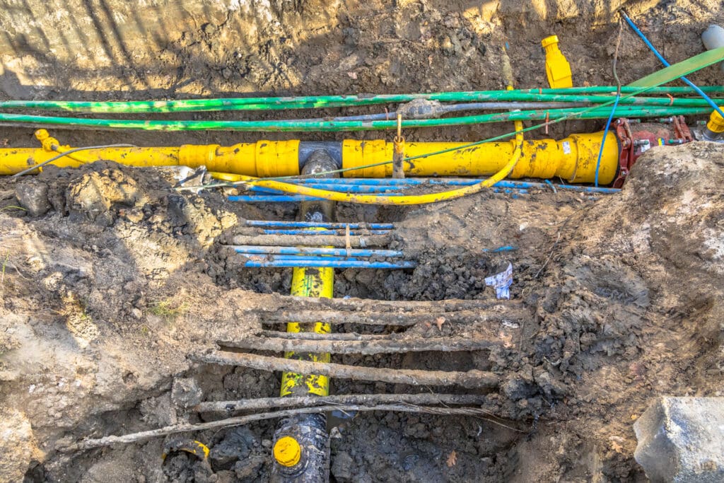
Water, sewer, septic systems, drainage, and utility access must often be evaluated as part of the subdivision process.
In some rural portions of the CSRA, soil evaluations may be necessary to determine septic suitability.
Environmental Considerations
Certain properties may contain:
- FEMA flood zones
- Wetlands
- Streams and buffers
- Conservation easements
- Utility easements
These factors can affect lot layout and development potential.
Step 2: Obtain a Boundary Survey
A professional boundary survey is the foundation of every successful subdivision project.
Before new lot lines can be established, the existing property boundaries must be accurately identified and verified.
A boundary survey will:
- Locate property corners
- Identify encroachments
- Verify acreage
- Locate easements
- Identify rights-of-way
- Establish legal boundary lines
Without an accurate survey, subdivision plans may be delayed or rejected during the approval process.
At H&M Surveying, our licensed surveyors utilize GPS, robotic total stations, historical deed research, and courthouse records to accurately establish property boundaries throughout Augusta and the CSRA.
Step 3: Develop a Preliminary Subdivision Layout
Once the property boundaries are established, a subdivision layout can be prepared.
The preliminary plat illustrates:
- Proposed lot lines
- Lot dimensions
- Road frontage
- Access points
- Easements
- Utility locations
- Existing improvements
This stage often identifies potential issues before formal submission, saving both time and money.
For larger development projects, coordination with civil engineers may also be required.
Step 4: Submit for Municipal or County Approval
Depending on the property’s location, subdivision approval may be required from:
- Augusta-Richmond County Planning Commission
- Columbia County Planning Department
- Burke County Planning and Development
- McDuffie County Planning Department
- Other local governing agencies
The review process typically evaluates:
- Zoning compliance
- Access requirements
- Utility service availability
- Stormwater impacts
- Future development compatibility
Simple family subdivisions may move quickly, while larger developments often require additional review and approvals.
Step 5: Final Plat Preparation and Recording
After receiving approval, a Final Plat is prepared.
The Final Plat becomes the official legal document creating the new lots.
The plat typically includes:
- Lot dimensions
- Property descriptions
- Easements
- Rights-of-way
- Survey certification
- Approval signatures
Once approved, the plat is recorded with the appropriate county office, officially establishing the new parcels.
Only after recording can the new lots typically be sold separately.
Common Challenges When Subdividing Property
Property subdivision projects can encounter several obstacles, including:
Inadequate Road Frontage
Many zoning districts require minimum frontage along public roads.
Existing Easements
Utility, drainage, or access easements may restrict where new lot lines can be placed.
Flood Zones
Properties near the Savannah River, Butler Creek, Spirit Creek, or other waterways may contain floodplain areas that impact development.
Zoning Restrictions
Minimum lot size requirements can limit the number of lots that can be created.
Utility Constraints
Lack of water, sewer, or septic suitability can affect lot feasibility.
Working with experienced surveying and development professionals early in the process helps identify these issues before they become costly problems.
Why Professional Surveying Matters
Subdivision projects rely on accurate property data.
Mistakes in boundary determination, easement identification, or plat preparation can create legal issues, project delays, and unexpected expenses.
Professional land surveyors provide:
- Boundary determination
- Plat preparation
- Easement research
- Topographic data
- Municipal coordination
- Development support
Having accurate survey information from the beginning allows property owners to make informed decisions and move confidently through the approval process.
Helping Augusta and CSRA Property Owners Navigate Subdivisions
From small family land divisions to large residential developments, H&M Surveying provides the surveying expertise needed to support successful subdivision projects throughout Augusta and the surrounding CSRA.
Our team understands the unique requirements of Richmond County, Columbia County, Burke County, McDuffie County, and neighboring jurisdictions. We work closely with property owners, developers, engineers, attorneys, and municipalities to streamline the subdivision process and keep projects moving forward.
If you’re considering subdividing property in Augusta, Evans, Grovetown, Martinez, Harlem, Appling, or anywhere in the CSRA, contact H&M Surveying today to discuss your project.
Frequently Asked Questions
Subdivision costs vary depending on the size of the property, number of lots being created, survey requirements, engineering needs, and local approval fees. A professional survey is typically one of the first costs involved.
Simple subdivisions may take a few weeks, while larger developments requiring planning commission approvals can take several months.
No. A professional boundary survey is generally required to accurately establish existing property lines and create new lot boundaries.
Yes. Many property owners subdivide land to transfer parcels to children or relatives. Local zoning and subdivision regulations still apply.
Potentially. Flood zones may limit buildable areas and influence lot design. A survey can help identify these constraints early in the planning process.
H&M Surveying serves Richmond County, Columbia County, Burke County, McDuffie County, Lincoln County, Aiken County, Edgefield County, and surrounding communities throughout the Augusta region.
