
H&M Surveying Completes 10,000+ Feet of Utility Corridor Surveying in the South Carolina Lowcountry
H&M Surveying Completes 10,000+ Feet of Utility Corridor Surveying in the South Carolina Lowcountry
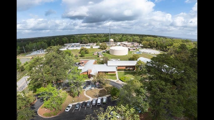
H&M Surveying recently completed surveying services for a major Beaufort-Jasper utility line project in the South Carolina Lowcountry, surveying more than 10,000 linear feet of new utility corridor to support the expansion of critical infrastructure for the region’s growing communities.
The project will allow the district to add redundant utility lines, strengthening the infrastructure needed to provide dependable service as population, development, and utility demand continue to grow throughout the Beaufort and Jasper County area.
For H&M Surveying, the project represents exactly what infrastructure surveying is designed to accomplish: provide engineers, utility providers, municipalities, and project stakeholders with accurate survey information they can use to plan, design, and ultimately construct the infrastructure a community depends on.
What Is a Utility Corridor Survey?
A utility corridor survey establishes accurate information about the land and existing conditions along the proposed route of a utility line.
Before a new utility line can move from planning into design and construction, engineers need reliable information about the corridor where the infrastructure will be located. Depending on the project, this may include existing topography, property and right-of-way information, existing utilities, structures, roadway features, drainage features, survey control, and other physical conditions that could affect the proposed design.
For the Beaufort-Jasper project, H&M Surveying completed survey work along more than 10,000 linear feet of proposed utility corridor, providing the project team with the survey data needed to support the next phases of the project.
That represents nearly two miles of corridor surveyed through the South Carolina Lowcountry.
Why Accurate Surveying Matters for Utility Line Projects
Utility infrastructure projects can cross long distances and interact with roads, properties, easements, existing utilities, drainage systems, environmental features, and other infrastructure.
Small errors can become significant problems when carried across thousands of feet of proposed construction.
Professional utility surveying helps engineers and infrastructure owners understand existing conditions before design decisions are finalized. Accurate survey information can help project teams identify potential conflicts, evaluate proposed alignments, coordinate easements and rights-of-way, and establish reliable horizontal and vertical control for future phases of the project.
The objective is straightforward: give the project team an accurate representation of the corridor before construction begins.
Building Redundancy Into Growing Utility Systems
Communities throughout the South Carolina Lowcountry continue to grow, and that growth places additional demands on public infrastructure.
Utility systems must not only provide sufficient capacity for today’s users but also prepare for future development and increasing demand.
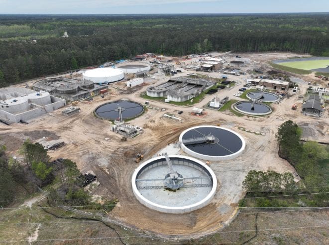
The Beaufort-Jasper project is intended to support the addition of redundant utility lines within the district’s system. Redundant infrastructure can provide additional routing and system flexibility while helping utility providers strengthen the reliability of the networks serving their communities.
Surveying is one of the first steps in making those improvements possible.
Before infrastructure can be engineered and installed, project teams need to know what exists on the ground, where the proposed corridor can be located, and how the project relates to surrounding properties and infrastructure.
Surveying More Than 10,000 Linear Feet of Utility Corridor
Long utility corridors present different surveying challenges than individual development sites.
Instead of concentrating survey work within a relatively compact property, survey teams may work across thousands of feet while maintaining consistent control and collecting the information necessary for engineering and design.
For this project, H&M Surveying’s team completed more than 10,000 linear feet of corridor surveying.
Maintaining reliable survey control throughout a corridor of this length is critical. The information collected across the project must function as one coordinated dataset so engineers can confidently use it during design.
That requires disciplined field procedures, accurate data collection, project coordination, and quality control throughout the survey process.
Utility and Infrastructure Surveying in Beaufort, Jasper County and the South Carolina Lowcountry
Infrastructure development throughout Beaufort County, Jasper County, Charleston, and the surrounding South Carolina Lowcountry continues to create demand for professional surveying services capable of supporting complex public and private projects.
H&M Surveying provides surveying services for utility providers, municipalities, engineering firms, developers, contractors, and public agencies throughout South Carolina.
Our infrastructure and utility surveying capabilities include:
- Utility corridor and route surveys
- Topographic and existing-conditions surveys
- Easement and right-of-way surveys
- Boundary and property surveys
- Survey control
- Subsurface Utility Engineering support
- GIS and utility mapping
- LiDAR and drone surveying
- Construction layout and staking
- As-built and record surveys
By combining traditional surveying with modern geospatial technologies, H&M can support projects from initial planning and existing-conditions mapping through design, construction, and final documentation.
Why Are Surveyors Needed Before a New Utility Line Is Built?
Engineers cannot effectively design a utility line without understanding the physical conditions along its proposed route.
A professional survey provides the spatial information necessary to understand where existing features are located and how the proposed infrastructure will interact with them.
Depending on the project, survey information may be used to support:
- Preliminary engineering and route selection
- Utility design
- Easement acquisition
- Right-of-way coordination
- Existing utility coordination
- Permitting
- Construction plans
- Construction staking
- As-built documentation
The earlier reliable survey information is incorporated into a project, the better positioned the project team is to identify potential issues before they reach construction.
Supporting the Infrastructure Behind South Carolina’s Growth
Projects like the Beaufort-Jasper utility line are a reminder that much of the infrastructure supporting a growing community begins with work most people never see.
Long before a new utility line is placed into service, surveyors, engineers, utility professionals, public agencies, contractors, and other project stakeholders work together to transform a proposed corridor into constructible infrastructure.
H&M Surveying is proud to have provided the surveying foundation for more than 10,000 linear feet of new utility corridor on this project and to continue supporting infrastructure improvements throughout the South Carolina Lowcountry.
Need a Surveyor for a Utility or Infrastructure Project in South Carolina?
H&M Surveying provides professional utility, infrastructure, topographic, right-of-way, easement, GIS, LiDAR, and construction surveying services throughout South Carolina and Georgia.
Whether a project involves a short utility extension, miles of proposed corridor, municipal infrastructure improvements, or a large civil development, our team can provide the survey information necessary to move the project from planning through construction.
Accuracy First, Customers Always.
